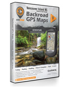
Vancouver Island BC Backroad GPS Maps
- To order or for more information on any of our many products and services please PHONE or EMAIL us. See our CONTACT US page
- Credit card orders are accepted by phone. Regular and rush shipping/delivery also available
- Canadian orders carry applicable taxes. USA orders, no taxes, duty/brokerage fee maybe added by courier (if applicable)
Vancouver Island BC Backroad GPS Maps
BC’s very own island paradise, Vancouver Island, is a world unto its own. The renowned city of Victoria, BC lies gleaming on the southern tip of the Island, attracting tourists year-round with its parliament buildings, unique Island culture, and artisanal treasures in a community surrounded by water. Heading north along either coast of Vancouver Island, visitors discover a world of natural wonders where coastal Island communities like Nanaimo, Tofino and Campbell River bleed into wild, temperate forests filled with fishing lakes, hiking trails, and provincial parks. With endless opportunities for camping, paddling, wildlife viewing, winter recreation, and more, nature lovers revel in the abundance of Vancouver Island hot spots. From the crashing waves of Tofino to the biking trails of Victoria, we put BC’s Vancouver Island on the map.
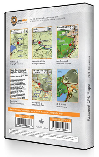
Backroad Mapbooks’ Vancouver Island BC GPS Maps use industry-leading technology to chart Vancouver Island with the most comprehensive topography on the market. These Garmin-licensed GPS maps are compatible with Garmin GPS and Garmin Basecamp to grant you access to detailed digital maps of Vancouver Island from your GPS device or computer. Available in Micro SD and DVD formats, the Vancouver Island GPS maps are designed for accessibility. Get connected and explore Vancouver Island with detailed shaded relief, 3D views, marked and labeled Wildlife Management Areas, trails, paddling routes, activity points-of-interest, routable roads and the most complete topographical coverage available. Developed in cooperation with local and government agencies, the Vancouver Island BC GPS maps are your reliable and technologically-advanced source for exploring all that Vancouver Island has to offer.
• Garmin GPS and Basecamp™ compatible
• 20,000 base scale topographic maps
• Detailed shaded relief for all of British Columbia
• 3D perspective on select Garmin GPS units and Basecamp™
• The most complete resource, industry and logging road coverage available for British Columbia
• Routable city, resource and industry roads
• Hundreds of thousands of kilometres of oilfield seismic roads and pipeline corridors
• Tens of thousands of kilometres of trail systems, including defined ATV, snowmobile, long distance & multi-use trails
• BC paddling routes with access points and portages
• Smart background & searchable Wildlife Management Units (WMUs) for anglers and hunters
• National, provincial and private parks & campsites
• Lake & stream fishing information with boat launches
• Geo-referenced searchable city recreation points-of-interest including museums, roadside attractions, urban parks and more
• Geo-referenced backcountry recreation points-of-interest including
• campsites, fishing hot spots, trail locations, backroad attractions and more
• Boat launches, campsites, paddling access points, ski areas and more
• Thousands of searchable resource facilities including compressor sites, gas plants and other facilities by operator name
• Find that worksite with searchable PNG grid locations
• Tens of thousands of searchable cities & geographic land and water features
• Updated city & rural streets
• Seamless topographic maps
• Now includes EXTRA searchable geocache locations
• And much more!
SD/Micro SD Card for Garmin GPS units - $69.90 cdn
|
|
|

